This is a SEO version of EAZ PLan. Click here to view full version
« Previous Page Table of Contents Next Page »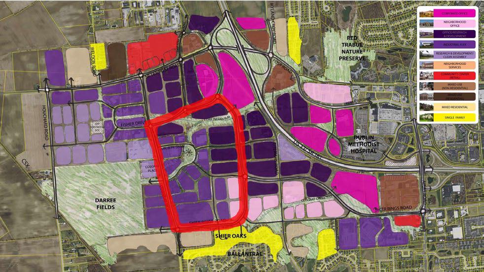
20 EC ONOM I C A D VANC EME NT ZONE
Considering Development Options
As part of the planning process for the EAZ, a number of conceptual road alignments and associated land use patterns were developed to ascertain public preferences. Discussion of multiple land use concepts provided valuable opportunity to further define specific issues that should be addressed in the EAZ.
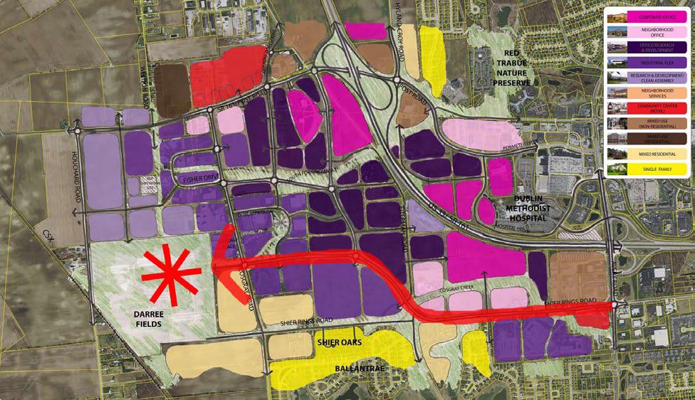
The Darree Connection
Based on resident concerns about traffic levels and park-related congestion, the Darree Connection proposes a realignment of Shier Rings Road northward to establish a new park entrance that addresses neighborhood impacts and enhances recreational access. The resulting alignment allowed portions of Shier Rings from Eiterman Road to Cosgray Road to be downplayed as a local street with a defined greenway connection between Darree Fields and the northern entrance to Ballantrae. The application of a modified grid off SR 161 gives enhanced site access to areas within the interior, but does not sufficiently address traffic trying to move through the area from SR 161 to Avery Road.
The Central Loop
The Central Loop concept considered the creation of a major circulation loop in the center of the EAZ by realigning Shier Rings northward to open up land along U.S. 33. While portions of Shier Rings Road were downplayed along residential areas, the concept impacted commercial access and made frontage property along the interstate too narrow to effectively market. The resulting loop system directly impacted some areas of residential use to the west along Shier Rings Road and did not result in a system that provided clear navigation to the interchanges. Many smaller commercial parcels were also negatively impacted by being separated from the major thoroughfare network for the EAZ.
This is a SEO version of EAZ PLan. Click here to view full version
« Previous Page Table of Contents Next Page »