11
SHIER RINGS ROADWAY CORRIDOR CHARACTER STUDY
Corridor Character | Analysis
CHARACTER DESCRIPTION
The Shier Rings Road corridor is primarily
a rural roadway consisting of two travel
lanes with a gravel shoulder on each side.
Vegetated swales handle storm-water run-
off. Shared use paths and sidewalks are
present along portions of the corridor.
The west terminus of the Shier Rings Road
corridor is at the intersection with Cosgray
Road. Between Cosgray and Eiterman
Roads, the road has two lanes with no curb
and gutter, with a right-of-way of about
45-55 feet, increasing up to 80 feet with
pedestrian facilities at Eiterman Road.
Between Eiterman Road and Avery Road,
the right-of-way varies between about
75-100 feet with a shared use path on the
south side of the road, where roadway
improvements have been made in
association with new development along
the south side of Shier Rings Road.
The Avery Road intersection is the most
significant intersection in the study area.
All legs of the intersection include at least
one turn lane, with pedestrian facilities
on both sides of Avery Road, but none on
Shier Rings Road.
Between Avery and Wilcox Roads, Shier
Rings Road is primarily two-lane without
curb and gutter and limited pedestrian
facilities.
The east terminus of the Shier Rings
Road corridor is at the intersection with
Shamrock Court and Dublin Industrial
Lane, near I-270. This section was improved
with pedestrian facilities when the Emerald
Parkway intersection was improved.
EXISTING DEVELOPMENT
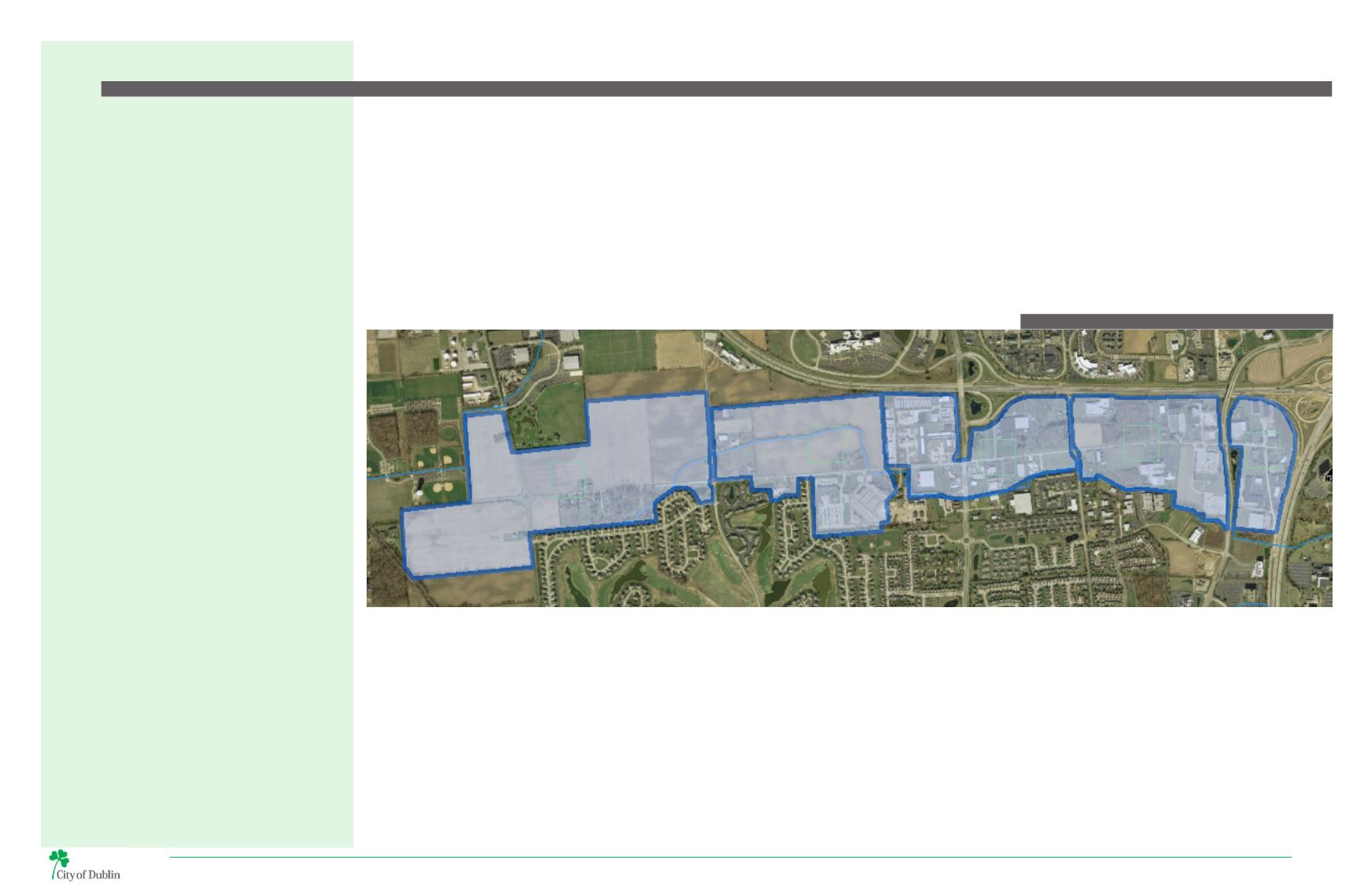
1
The residential character along the south side of the
roadway continues west of Eiterman Road toward
Cosgray Road, where established, large-lot single-
family homes within unincorporated Washington
Township are situated. Three large undeveloped
parcels within the township are located at the west
end of the Shier Rings Road corridor.
Existing development along Shier Rings Road varies
greatly in land use and character. Most buildings are
one- to two-stories, although building materials and
overall aesthetic character changes dramatically from
one end of the corridor to the other.
4
The study area east of Avery Road includes a
mixture of light industrial, manufacturing, and
office uses. This area began developing in the early
1980s and is characterized by one-story brick and
masonry buildings. Larger uses, including American
Electric Power, Hidaka USA, LabCorp, the City of
Dublin’s development offices, and Smiths Medical are
located west of Emerald Parkway, along with smaller
office and light industrial uses.
3
The development around the intersection
with Avery Road represents some of the oldest
commercial development in the study area. This
area includes Hilliard’s Furniture, two self-storage
businesses, and other heavier industrial uses. The
southwest corner of the intersection includes single-
story office buildings that currently house Dublin
Building Systems.
2
The Shier Rings Road corridor transitions to a
combination of agricultural, institutional, and
residential uses west of Avery Road. The Dublin City
School District transportation facility and the City
of Dublin’s Service Center and Fleet Maintenance
complexes are all on the south side of the road. The
Ballantrae neighborhood, which contains a mix of
single-family and clustered condominium homes,
winds around the Golf Club of Dublin. Properties
on the north side of the road are presently used for
agricultural purposes until they annex into the City of
Dublin and are prepared for development.
5
The study area east of Emerald Parkway which
abuts the 33/161 - I-270 interchange, is also
characterized by one story brick buildings. Many of
the buildings have multiple business types and uses.
Highly visible along interstate 270,the density of
development can be increased.
5
3
4
1
2
MAP 7 | EXISTING DEVELOPMENT AREAS


