8
SHIER RINGS ROADWAY CORRIDOR CHARACTER STUDY
Corridor Character | Policy
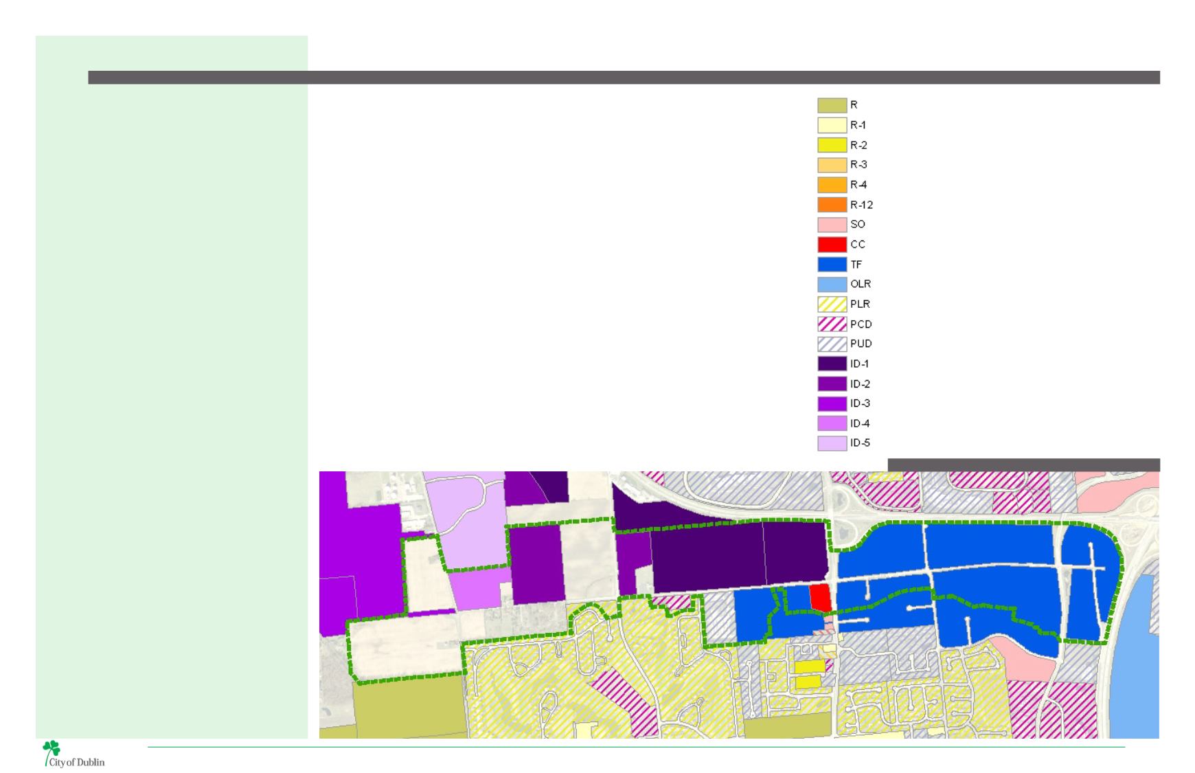
EXISTING ZONING DISTRICTS
On the north side of Shier Rings Road, and west of Avery
Road the properties in the City of Dublin are zoned
InnovationDistrict (ID-1, ID-2, and ID-4) and are all part of
theWest Innovation District. TheWest Innovation District
complements the Technology Flex zoning district by
serving as a center for technology and research-oriented
uses and businesses.
West of Avery Road, zoning districts and land uses are
muchmorediverse.Thesouthsideoftheroadwayincludes
a mixture of zoning districts including: Technology Flex,
Community Commercial, Planned Commercial District,
and Planned Low Density Residential District.
The east half of the Shier Rings Road corridor is zoned
as a Technology Flex zoning district. This zoning type
provides for a broad range of research, office, laboratory,
and clean manufacturing uses. The district was designed
to support light industrial uses to accommodate the
business in existence in the study area today and attract
new businesses in modern industrial applications
such as prototyping, specialized assembly, and clean
manufacturing.
Development isdesigned to transition in scale south from
four or more stories along US 33 down to approximately
two stories along Shier Rings Road, where in some
areas, development will be located adjacent to existing
residential neighborhoods.
WHAT IS THE COMMUNITY PLAN?
The Community Plan is the key policy guide
for decision-making about Dublin’s built
and natural environments. The Community
Plan text and associated maps contain
detailed recommendations for future
development including the appropriate
location and density or intensity of
residential and commercial uses; the
general location and character of roads;
the general location of parks, open space
and public buildings.
The Community Plan is a guide for City
Council and the Planning and Zoning
Commission as they assess the location,
character, and extent of proposed public
and private development in Dublin. The
Plan is designed as a short-, medium- and
long-range guide for decision-making.
The Land Use Plan, Transportation Plan
and Special Area Plans together form the
foundation of the Community Plan. The
Land Use Principles, Future Land Use Map
and Land Use Classifications are important
components of the Land Use Plan, while
the Thoroughfare Plan is the primary
policy tool within the Transportation
Plan. The Special Area Plans provide a
more in-depth depiction of how the
Land Use and Transportation Plans may
be implemented in key areas of the city
that are expected to undergo significant
change. These elements of the Plan serve
to guide decision-making regarding the
appropriateness of development proposals
and the infrastructure improvements
necessary to support future development.
LEGEND
RURAL
RESTRICTED SUBURBAN RESIDENTIAL - 1
LIMITED SUBURBAN RESIDENTIAL - 2
SUBURBAN RESIDENTIAL - 3
SUBURBAN RESIDENTIAL - 4
URBAN RESIDENTIAL - 12
SUBURBAN OFFICE & INSTITUTIONAL
COMMUNITY COMMERCIAL
TECH / FLEX
OFFICE, LABORATORY, RESEARCH
PLANNED LOW DENSITY RESIDENTIAL
PLANNED COMMERCIAL DISTRICT
PLANNED UNIT DEVELOPMENT
INNOVATION DISTRICT- 1 - RESEARCH OFFICE
INNOVATION DISTRICT - 2- RESEARCH FLEX
INNOVATION DISTRICT - 3 - RESEARCH ASSEMBLY
INNOVATION DISTRICT - 4 - MIXED USE
INNOVATION DISTRICT - 5 - RECREATION
MAP 3 | EXISTING ZONING DISTRICTS


