Dublin has participated in the National Flood Insurance Program (NFIP) since 1980 by Ordinance 27-80. The NFIP makes flood insurance available to property owners in communities that agree to adopt an ordinance regulating development in flood prone areas. The floodplain regulations required by NFIP are designed to accomplish three basic objectives related to flood damage protection:
- To prevent new developments from unduly increasing flood damages to others;
- To ensure that new buildings will be free from flood damage; and
- To ensure that existing buildings, when substantially damaged or improved, will be brought up to current floodplain regulations so they will be flood protected.
Dublin’s code exceeds these minimum requirements. Chapter 151 – Flood Control requires the necessary controls and provisions, but also includes a 20 foot buffer zone to floodways. No fill shall be placed between the floodway and the base flood elevation (flood fringe) or between the floodway and 20 feet from the floodway, whichever is less. See the graphic below for additional clarification.

Click here for detailed information on Floodplain Regulations in Ohio
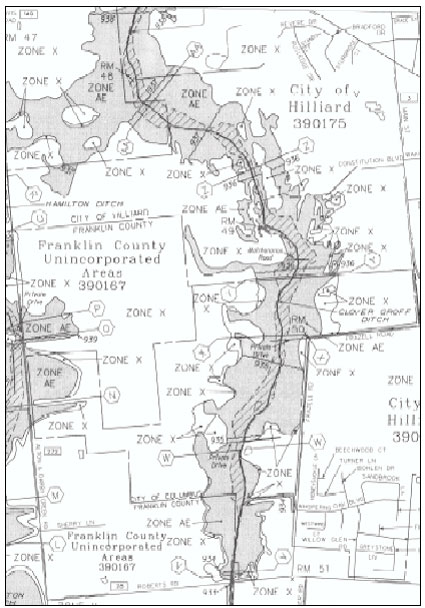
Under NFIP, the Special Flood Hazard Area (SFHA), otherwise known as the Floodplain or 1 percent chance of a flood, is the area of land that would be inundated by the base flood (see the above graphic.) This floodplain is the area regulated by Dublin for compliance with the NFIP and where the mandatory flood insurance purchase requirement applies. The floodplain is shown on the Flood Insurance Rate Maps (FIRM) provided by the Federal Emergency Management Agency (FEMA). These are the maps that lending institutions use to determine if floodplain insurance is required for a property.
If you are doing work in the SFHA, you will be required, as part of the building permit, to also submit a Special Flood Hazard Area Development Permit Application (SFHADPA) along with the required fee. Engineering will review the application for compliance with Chapter 151 – Flood Control Requirements. To assist applicants with obtaining SFHA Development Permits, the City has developed an Administrative Policy – Special Flood Hazard Area Permitting. Click here for a link to the Policy. Follow this link to the application forms Click here for form.
Over the years FEMA has updated the maps with current information obtained from studies and applications to change the maps. In 2005, FEMA initiated a Multi-Hazard Flood Map Modernization effort, which will result in the improved accuracy and expanded utility of the of the nation’s current flood map resources. Click here for a more detailed explanation of the changes to the maps. These maps are effective June 17, 2008.
The new FIRMs will have the following impact to Dublin
Number of Parcels Affected | Cause of Change
59 | New to the Flood Fringe
32 | New to the Floodway
55 | Removed from Flood Fringe still in Floodway
81 | Removed Flood Fringe and Floodway
16 | Removed from Floodway still in Flood Fringe
If the new maps show your property in a different flood zone than where it was previously, Click here for information on Grandfather Rules.
Click here for information on the NFIP Summary of Coverage
If you have questions or concerns please contact us or call the Engineering Department at 614.410.4600.
Enter your address below to determine if your home is affected by the new maps.

